
Image by RLS Photo, licensed via Adobe Stock (Education License)
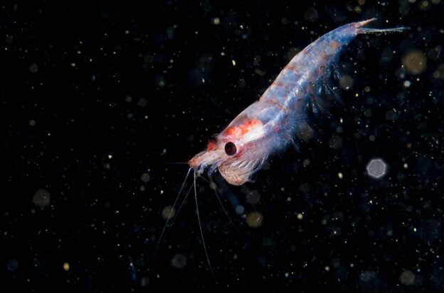
In Antarctica’s frigid waters, tiny shrimp-like creatures called krill are the foundation of the entire ocean food web, feeding everything from penguins to whales. But how do these krill—and the microscopic plants they eat—end up in the right place at the right time? A new study reveals that ocean currents act like invisible highways, concentrating food into specific areas where hungry predators know to look.
Josh Kohut, professor in the Department of Marine and Coastal Sciences and SEBS Dean of Research/NJAES Director of Research, is an affiliate of the Rutgers Climate and Energy Institute and co-author on the study. Kohut worked with an international team of researchers to map how tides control where food gathers in Palmer Deep Canyon, Antarctica. Their research was published as a conference proceeding for the OCEANS 2025 Brest Conference in IEEE Xplore.
This region undergoes a unique tidal shift in which some days there are two high tides and other days only one. The authors discovered that the shift from one tidal regime to the other dramatically changes where phytoplankton (microscopic ocean plants) and krill cluster. During periods with two high tides per day, called semi-diurnal tides, ocean currents create strong gathering zones concentrated on one side of the underwater canyon. During periods with just one high tide daily, called diurnal tides, these food hotspots shift to different locations. The team used high-frequency radar to track ocean surface currents, underwater acoustics to detect krill swarms, and optical sensors to map phytoplankton patches.
This research connects directly to climate concerns in Antarctica, one of Earth’s fastest-warming regions. Understanding how food at the base of the food web is concentrated matters because climate change is already disrupting Antarctic ecosystems. However, since tidal patterns themselves won’t change with warming, these predictable food highways may provide crucial stability for Antarctic wildlife even as other environmental conditions shift.
“These findings help us understand where and why penguins and other predators go to certain areas to feed,” said Kohut. “By revealing how and where tides concentrate prey, we can better predict where marine life will gather and make smarter decisions about protecting these critical feeding grounds in our changing climate.”
The practical implications extend beyond wildlife conservation. This approach can be applied in other regions. For example, fisheries managers could use this knowledge to avoid disrupting important feeding areas for endangered species. Marine protected area planners could identify zones that naturally concentrate food resources, ensuring the most critical habitats receive protection. You can read the full study here:
This article was written with assistance from Artificial Intelligence, was reviewed and edited by Oliver Stringham, and was reviewed by Josh Kohut, a co-author on the study.
