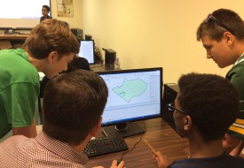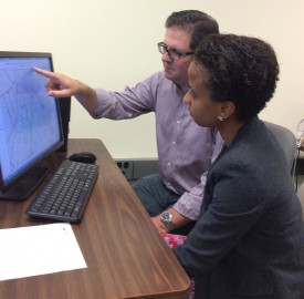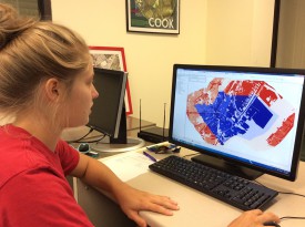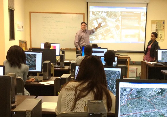
David Tulloch instructs participants in the GeoHealth Workshop held at CRSSA on the Cook Campus. Alejandrina Canelo Villafana, Ph.D. candidate from Columbia University, looks on..
A unique GeoHealth Workshop at Rutgers over the summer engaged over a dozen students in exploring spatial technology and what it reveals about health in the urban landscape.
Held at the Rutgers Grant F. Walton Center for Remote Sensing and Spatial Analysis (CRSSA) on the Cook Campus, the workshop was facilitated and conducted by David Tulloch, associate director for program development and GIS applications program leader at the center.
Participants were a mix of high school and college students, ranging from high school freshmen to a doctoral candidate, and included several undergraduates from Rutgers–New Brunswick and Rutgers–Newark, Kean University, Jersey City University and Union County College.
In addition to giving them a head start on understanding the options and hands-on skills related to geospatial and mapping technology, one broad objective of the workshop was to demonstrate to the students that the health field is more than the clinical, said Tulloch.
Over the course of the workshop, participants spent each morning learning some mapping skills, using some pre-loaded data from CRSSA’s extensive databank as well as using and creating new data. In the afternoons, a guest speaker was invited to speak to the students on real health issues in the field.
“The goal here was to try to help the students think about health in the absolute broadest terms,” said Tulloch.
A recurring theme that Tulloch observed for the week was just how much there was to impart to the students about spatial science, health science and working with the technology. “It makes us appreciate why it takes so many people and collaborations to come up with solutions,” said Tulloch.
The idea for the one-week workshop grew out of a wider focus by CRSSA to build capacity in its GeoHealth lab, which has dedicated lab space within the center. For the past five years, the lab, with funding from Robert Wood Johnson and the NIH, has been engaged in a five-year study on childhood obesity partnered with the Center for State Health Policy.
According to Tulloch, the connections of these kinds of studies are not always made back to education, so “part of the thinking behind running the workshop was to make sure that the research at CRSSA has that connection back to the students.”
Why Elizabeth, NJ? Tulloch has had a more than 10-year relationship working on various projects with Future City, Inc., a non-profit community group in the city, which sent six of its interns, ranging from high school to college, to the workshop.
He explained why he chose to have the workshop participants concentrate on mapping the city of Elizabeth. “Elizabeth, as a city, has a nice balance of dense, walkable urban landscape,—with the very real relationship where walking and exercise is linked to health—we get to see the interaction of environmental and health issues play out.”
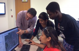
Prof. David Tulloch points to an image on the screen. On his left are workshop participants Sree Thogarchedu, Agurami Agbeyegbe and Tara Viray.
Located near the Newark Liberty airport and the New Jersey Turnpike and Route 1 corridors, air quality and noise pollution are real environmental concerns. In addition, because of its relatively small size, the city of Elizabeth has a “nice, scalable urban structure that lends itself to understanding quite quickly.”
The other thing that drew Tulloch to Elizabeth is that it does not always get the attention of higher profile cities like Newark, Camden and even Paterson.
“I also find that students really like the idea of revealing something that no one else knows – they like to feel like they’re discovering new things,” so Elizabeth presented itself as an attractive study for a health mapping project.
One group of students created new spatial datasets, mapping the locations of community health clinics that were available from official sources. Another group mapped healthy food outlets, community gardens, supermarkets and fruit stands, to be aggregated into one map.
As a designer — Tulloch is also an associate professor with the Department of Landscape Architecture — he feels a map can help provide simple connections to change conditions; for example, the walking distance to a farmers market may be dramatically reduced with a footbridge over a highway, to ensure greater access.
For example, creating a simple map of where farmers markets are located can make a big difference. “People who feel that they don’t have access to healthy foods may be surprised when they see where options are.”
Tulloch stressed that the workshop is more than an exercise to teach students about mapping technology. The goal is to have the maps the students create posted to a “story map,” an interactive map with detailed explanations so that groups like Future City, Inc., could utilize the data in its community health efforts, and even share data with policymakers and residents alike.
“These communities have so many opportunities for information and design to improve the lives of residents – and the mapping we’re doing can make such a quick impact in the face of dealing with very complex issues.”
The visualization through maps “helps people understand problems that seem impossibly complex as a finite condition that they can grapple with,” added Tulloch. “A simple connection could be made to change their perspective.”
To Tulloch, the additional benefits of the workshop included non-GIS students discovering how the technology connects to a number of fields of study and for those students who are pursuing more technical coursework to understand how mapping technology is applicable to many varied fields.
Alejandrina Canelo Villafana, who is pursuing an Ed.D. at Teachers College of Columbia University, has never worked with GIS technology before. A project coordinator with Future City, in Elizabeth NJ, she decided to enroll in the workshop along with the six interns she helps oversee at the non-profit organization.
“The built environment plays an important role in understanding chronic disease,” she said. “Since I’m pursuing a doctorate in Health Education I very much wanted to see how this new technology could apply to and address health behavior.”
She’s using the workshop training as a foundation for her next class in Public Health in the fall semester at Columbia and plans to incorporate GIS health mapping in her doctoral dissertation.
Given her background in public health, Villafana quickly began serving as a facilitator at the workshop, assisting Tulloch in shaping the students’ understanding of the relationship between access to healthy options and the prevalence of chronic disease.
Kate Brandt, a rising sophomore at Rutgers School of Arts and Sciences, participated in the workshop to learn new GIS skills and served as an ad-hoc assistant with mostly the high school students who were encountering the technology for the first time.
“I spent part of the early summer in an internship with the Landscape Architecture department where I learned some GIS skills and I’m here learning how to apply this to social analysis,” she said.
Brandt plans to double major in Environmental Policy and Design through the Department of Landscape Architecture, and Urban Planning and Design through the Bloustein School of Planning and Public Policy.

