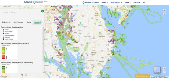
Screenshot of coastal recreation and boating mapping data on the Mid-Atlantic Ocean Data Portal.
Funding will support collaboration by Rutgers, The Nature Conservancy and Monmouth University’s Urban Coast Institute.
The Monmouth University Urban Coast Institute (UCI) has received a $1.2 million Gordon and Betty Moore Foundation grant to continue the development of the Mid-Atlantic Ocean Data Portal (portal.midatlanticocean.org), a free, state-of-the-art mapping and information site focused on ocean areas from New York through Virginia. The funding will support the work of a project team consisting of researchers from Rutgers University’s Edward J. Bloustein School of Planning and Public Policy and the Center for Remote Sensing and Spatial Analysis (CRSSA), The Nature Conservancy and the UCI.
The grant will enable the UCI and its project partners to add valuable new content to the publicly accessible site in 2016 and 2017, including interactive maps depicting fishing areas, oceanography, tribal ocean uses and a trove of data that will illustrate marine life distributions and trends throughout the East Coast in greater detail than ever before. The Portal was initiated under the guidance of the Mid-Atlantic Regional Council on the Oceans (MARCO) with previous funding provided by the Moore Foundation in 2015 and the National Oceanic and Atmospheric Administration in 2012 and 2013.
“We are deeply grateful for the vital contributions the Moore Foundation has made not just to the Portal project, but in improving the state of ocean planning in the Mid-Atlantic and other regions,” said UCI Director Tony MacDonald. “This technology will help policymakers and regulatory agencies make science-based decisions that promote healthy marine ecosystems and sustainable ocean use, as well as provide the public and stakeholders with readily accessible spatial data and the best information available about ocean environments and economies.”

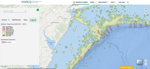
Screenshot of fishing and canyons data on the Portal.
Just as Google Maps and MapQuest contain data layers that depict the locations of businesses, transit stops and public places, the Portal offers a selection of over 200 layers depicting human activities and natural processes taking place at sea. The Portal has grown in importance as an ocean planning tool, particularly for its ability to illustrate where there are possible conflicts – for example, between a potential offshore wind site and shipping traffic – and compatible uses at sea.
The Portal has served as a key information source for a historic first-ever Draft Mid-Atlantic Regional Ocean Action Plan produced by a Regional Planning Body composed of representatives from six states, tribal entities, federal agencies and the Mid-Atlantic Fishery Management Council. In addition, it supports the work of MARCO, a partnership of the governors of Delaware, Maryland, New Jersey, New York and Virginia.
Under the current project funding from the UCI and the Moore Foundation, Rutgers has a leading role in the operational management of the Portal and in developing a plan to support the implementation of the Draft Ocean Action Plan and continued work by MARCO.
“The portal project has been a great demonstration of collaboration between Monmouth and Rutgers universities,” said Jeanne Herb, associate director of the Environmental Analysis and Communications (EAC) Group at Rutgers University’s Edward J. Bloustein School of Planning and Public Policy. “Our work together is a model for how institutions that house unique skills and expertise can complement each other, and we look forward to building on this partnership for projects, programming and academic opportunities in the future.”
According to Richard G. Lathrop Jr., director of CRSSA, a major goal has been to make the Portal a central information hub accessible to all of the Mid-Atlantic’s stakeholders.
“This has entailed working with stakeholders to better understand their decision-making needs and policy concerns, as well as designing the user interface to be simple and user friendly, but still allow ready access to the incredibly rich data set,” Lathrop said. “Working with MARCO on developing the Portal has challenged the team here at Rutgers to expand our expertise in land use planning, policy and geographic information systems into the coastal and marine realm.
The Draft Ocean Action Plan calls for the Portal to play an increased role in informing ocean management decisions such as siting offshore wind turbines, permitting aquaculture operations, and determining which fishing communities should be consulted when an area is being considered for sand extraction. An emphasis of the Portal team’s upcoming work will be to support the work and goals of the Draft Ocean Action Plan, which is open for public comment through Sept. 6 at boem.gov/ocean-action-plan.

